Roads and Trails Plan
The federal government established a short comment period for the Roads & Trails plan within the Ozark National 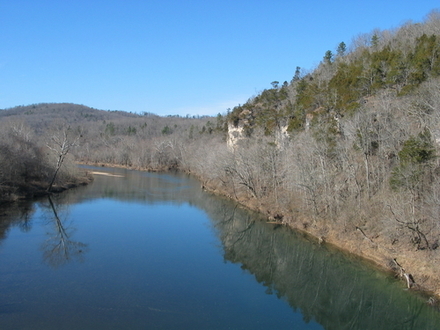 Scenic Riverways. MCE worked with other organizations to developed the following citizens guide for you to comment on the plan. The deadline for comments is January 15, 2018. Friends of Ozark Riverways is an affiliate organization of the Missouri Coalition for the Environment.
FRIENDS OF OZARK RIVERWAYS (FOR)
CITIZEN GUIDE FOR COMMENTING OZARK NATIONAL SCENIC RIVERWAYS (ONSR) ROADS & TRAILS PLAN—Preliminary Alternatives Comment Deadline January 15, 2018
Friends of Ozark Riverways (FOR) has reviewed the preliminary alternatives for the ONSR Roads and Trails Plan and considered its various management alternatives. We provide this summary of the three alternatives and FOR’s recommendations as a guide for those interested in commenting. We commend the National Park Service for addressing many of the issues that have been festering at ONSR for decades. Now is the time for all citizens who love parks and especially for all who have visited the Riverways to make your views known.
Date of Release and Deadline for Comment. A Preliminary Alternatives Newsletter and dozens of on-line maps were released to the public November 17, 2017, for a public comment period later extended to January 15, 2018. For links to view or download a copy of the newsletter, to review detailed maps of roads and trails proposed for the various alternatives, and to submit comments, visit http://parkplanning.nps.gov/OZAR_RTplan.
Comments must be submitted by January 15, 2017 at 11:59 pm Mountain Time in one of three ways:
• Online using links at: http://parkplanning.nps.gov/OZAR_RTplan (this is best); click on “Comment Now” in the left margin or scroll down to links to view maps and newsletter and to comment.
• By mail to: Attn: Roads & Trails Planning Team, USDI NPS Ozark National Scenic Riverways, P.O. Box 490, Van Buren, MO 63965 (Note: Post offices are closed Jan 14 & 15, so the last day for a postmark is likely Saturday, January 13.)
• Or, if necessary, by email to Dena Matteson: dena_matteson@nps.gov
Background. Ozark National Scenic Riverways, established by Congress in 1964, is Missouri’s largest national park and America’s first national river. There are 134 miles of the Current and Jacks Fork rivers in the park within Carter, Dent, Shannon, and Texas counties. The Riverways includes lands that were originally state parks (Alley Spring, Big Spring, and Round Spring); other lands were added after the park was established, and today its size and the quality of its resources are truly national in scope. Our review is focused on the long-term stewardship of the stunning beauty of the Riverways, its outstanding springs and caves, its diverse and widely recognized wildlife, its important cultural resources and landscapes, and the river-based recreational experiences provided by its free-flowing and high-quality rivers. Many of these resources are globally significant and irreplaceable. As a unit of the National Park System, the purpose for management of Ozark National Scenic Riverways is to protect these resources in an unimpaired condition for public recreation, education, and scientific value.
Planning History and Alternatives. The Roads and Trails Plan Preliminary Alternatives are based on a General Management Plan (GMP) approved in 2014 after nearly a decade of spirited contention between those who wanted no change from current conditions and those like FOR who wanted the park to be managed in accordance with National Park Service standards and policies. Conditions as of 2014 included a maze of often poorly located, redundant, and eroded user-created roads, trails, river access points, and campsites, and horse crossings far in excess of those intended in any previous plans. NPS planners found more than 90 miles of undesignated equestrian trails and more than 39 miles of undesignated off-road vehicle roads and traces since an earlier 1991 Roads and Trails Study, which had itself been undertaken by NPS to develop a protocol for closing unauthorized, user-created roads, trails, and access points, relatively few of which were subsequently closed.
While the 2014 GMP did not satisfy all users, it was regarded by many—including most members of Friends of Ozark Riverways—as a reasonable compromise that, if implemented, would bring ONSR into compliance with National Park System standards and policies. Completion of a Roads and Trails Plan is essential for implementation. In the meantime, the 2014 GMP sets the standard for Alternative A, the No Action Alternative, which provides that all undesignated roads, trails, river crossings, campsites or other recreational areas would be closed and restored to natural conditions.
Alternative B would reduce the mileage of designated public roads from 210 to 189 miles (converting some to trails), and provide 35 miles of newly designated trails for various combinations of hiking, horse riding, and mountain biking, along with a horse staging area and eight designated river crossings on the Upper Current, which has none designated at present. Alternative C would provide 201 miles of public roads, 50 miles of newly designated trails, two new horse staging areas, and possibly a horse camp.
Both B & C would provide designated camping areas for motor vehicle access to gravel bars at Logyard and Two Rivers and walk-in camping at certain other gravel bars, along with continued access by watercraft to gravel bar camping. Both B & C would also offer the possibility of developing additional trail loops in partnership with neighboring landowners. For more details and comparison of the alternatives, see the newsletter and maps on the NPS planning website.
Friends of Ozark Riverways Recommendations and Comment Guide for Citizens
1. FOR recommends general support for Alternative B. This, in general, is a responsible alternative that would provide for designated horse trails and river crossings on the upper Current, where there are none designated at present, while providing also for more hiking and some biking trails. It goes farther than the other alternatives in reducing motorized intrusion on gravel bars and river banks via unauthorized user-created roads and river access points, reducing equestrian overuse and damage to resources, and providing for ecological restoration and improved visitor experience. Below, we comment further on longstanding FOR concerns and make recommendations for improvements that we believe would strengthen the plan.
2. Motorized intrusions to gravel bars and river banks should be strictly limited. FOR’s major concern throughout the GMP process to the present has been the numerous user-created accesses for motor vehicles (including RVs and campers) where they may be viewed from the river, so we appreciate NPS planners’ intent to greatly limit these intrusions by prohibiting driving onto or camping with vehicles on gravel bars, except for designated areas at Two Rivers and Logyard gravel bars (which some FOR affiliates may oppose), and of course for launching watercraft at designated launch sites.
The same, we believe, should apply to river banks; that is, motor vehicles should not be visible along the bank from watercraft passing on the river, except at launch sites and designated roads and fords. Most NPS campgrounds have been placed at sites naturally screened from the river, and the same should apply to vehicular camping or other vehicle use at designated recreation areas. We encourage NPS to provide parking areas screened from the river for walk-in camping and day use.
3. Designated recreation areas should be carefully sited and designed to prevent erosion and other degradation and to screen motor vehicles and campers from the river. These areas, most of them previously undesignated and user-created, were formerly termed “primitive areas,” a misnomer at best (in view of ubiquitous motor vehicles), and most were not identified on any public maps. The term “primitive area” still occurs on the maps in the newsletter and online, and should be changed. Now that NPS proposes to designate and sign 78 (Alt-B) or 86 (Alt-C) as recreation areas, it is important to establish carrying capacity guidelines or limits for certain sites, based on careful field investigation.
We believe some of the recreation areas should be accessible from the river only, to provide camping at sites where there may not be adequate gravel bars for watercraft camping. We also think those on the right descending side of the river between Cedar Grove and Round Spring, with the exception of the one at Akers Ferry, should be closed or accessed only from the river, since at least one side of the river on the upper Current should be free of motorized intrusion and related development, and the right descending bank is more remote and therefore difficult to manage and patrol. This is particularly the case at the area across the river from Welch Spring; the spring and other sites on the left bank attract many visitors (most arriving by a motor vehicle), who should not be assaulted by development directly across the river.
4. Close, physically block, and restore undesignated roads, traces, and equestrian trails. This step is critical, and it must proceed in tandem with the designation of roads, recreation areas, and equestrian trails.
5. Provide carefully designed, sustainable equestrian trails and river crossings in the upper Current River area. Because equestrian use has increased dramatically in this area in recent decades on a maze of user-created trails and there are currently no designated trails, it is critical to provide designated trails and crossings. We think it is not feasible to provide more miles and crossings on national park fee lands than in Alt-B; indeed, we think eight crossings in the seven miles between Parker School and Welch on the upper Current is too many. But there may be opportunities for even more miles of trail in that area through partnership agreements with neighboring landowners to develop loops north and east of the river.
 We ask you to drop consideration of the horse campground mentioned in Alt-C because we think NPS-owned lands in the corridor are too limited and the need could more appropriately be met by a commercial operation on private land outside the park. We also oppose the horse staging area near Welch Landing in Alt-C because that area is simply too congested with visitor parking, the watercraft landing, and foot traffic to the spring and related sites. It would be helpful, however, to find a place for a hitching rack, so equestrians could leave their horses and walk to the spring and other sites. In the Bee Bluff area (section 4), we oppose the extension of the equestrian trail in Alt-C from the Jerktail loop to Bee Bluff and farther north to the new Current River Trail to Round Spring, as this will only invite unauthorized equestrian use of the new Current River Trail, which has been designed to be hiking only.
6. Provide more miles of trails for hiking only. Most of the new equestrian trails proposed for the upper Current are designated hiking and equestrian, but the frequent river crossings are not feasible for most people on foot so they are trail snippets only. We applaud the new Current River Trail (termed “Round Spring Spur of the Ozark Trail” in the newsletter) and its proposed extension to Echo Bluff and Current River State Parks and think its partnership approach across multiple ownerships might well be applied in further extending the trail to Pulltite. It would be a popular trail for many visitors in the area.
At Pulltite, however, there is a proposed mountain biking trail sharing part or all (not clear) of the nature trail, which we think is extremely problematical and dangerous for families with children moving slowly on the nature trail. On the old tram road to Big Spring, however, the tread is wide enough so a shared hiking/biking trail might work. There are ample gravel roads available in and beyond the park for mountain biking, though there may be places where short connectors could facilitate loop bike routes.
Summary Comments.
We believe the NPS deserves support for its commitment to dealing with serious problems that have developed over the years. However, the Riverways has seen a reduction in staff in the last decade well in excess of one third, owing to decreases in funding, and there is no guarantee that funds will be enhanced to the levels required by the plan alternatives. That is a major reason for cautioning against the greater miles of designated roads, trails, and recreation areas in Alternative C that would require more funds for development and increases in staffing to monitor resources and provide enforcement. We favor maintaining visitation at approximately the current level while emphasizing improvements that are less staff-intensive and more conducive to family recreation.
We encourage all citizens who care about the future of the Riverways to submit comments on this plan by January 15.
Friends of Ozark Riverways. The following organizations and businesses from across Missouri have affiliated with FOR and its work on behalf of this outstanding national park:
Al Agnew (Wildlife Art Alpine Shop), Audubon Missouri, Conservation Federation of Missouri, East Ozarks Audubon Society, Environment Missouri, Great Rivers Environmental Law Center, L-A-D Foundation, Missouri Archaeological Society, Missouri Coalition for the Environment, Missouri Parks Association, Missouri Smallmouth Alliance, Missouri Wilderness Coalition, Open Space Council, St. Louis Ozark Fly Fishers, Ozark Greenways, Springfield Ozark Society (Missouri, Arkansas, and Oklahoma), Ozark Wilderness Waterways Club (Kansas City), Pioneer Forest (Salem, MO), Sierra Club (Missouri Chapter), St. Louis Adventure Group, St. Louis Canoe and Kayak Club.
