Introduction Congress is struggling to pass a new Farm Bill- which is required once every 5 years. This important piece of legislation provides funding for important agricultural and environmental programs which support our farmers as well as funding for programs that help put food in the hands of folks who need it most. What’s the…
Read MoreTimeline of CAFO Policy
MCE Policy Team created this timeline in partnership with Missourian Cheryl Marcum
Read MoreMake no mistake, SJR 74 is bad for democracy even without the “candy”
What Happened? After the Senate Democrats filibustered starting evening of Monday, February 19 through the night and into Tuesday, February 20, the Senate Republicans stripped provisions from SJR 74 deemed by critics as “ballot candy” that the GOP legislators hoped would get Democrats to support the bill. Senate Democrats filibustered for twenty hours, making clear…
Read More
Where We Stand in Missouri After the U.S. Supreme Court’s Attack on Clean Water
Written by MCE Member and water policy expert, Charles Miller It’s been eight months since the Supreme Court handed down its legally and scientifically baseless decision in Sackett v. EPA that gutted federal protections for wetlands. This radical decision has already wreaked havoc on wetlands jurisdiction, reducing federal authority over wetlands to levels not seen…
Read More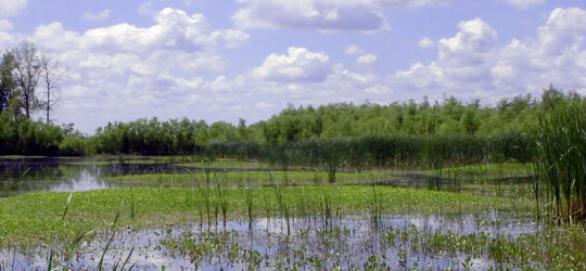
Missouri Coalition for the Environment’s 2024 Position on Mining in Missouri
Introduction Mining must be done responsibly and limit impacts on current and future Missourians. Mining of certain critical minerals is important for technological devices we use in everyday life and for renewable energy infrastructure. Missouri Coalition for the Environment believes Missouri must embrace effective safe mining practices for the health and safety of mining workers,…
Read More2023 Fall Alert
The Alert Newsletter is published by the Missouri Coalition for the Environment twice per year, in the Spring and Fall. Members of MCE receive a mailed version of the newsletter prior to the digital version being uploaded on the website.
Read More2024 Missouri Legislature Bill Tracker
New Things in MCE’s Tracker This Year: Bills Tracked by Priority Bills Tracked by Position Fact Sheets on Priority or Emerging Issues
Read More