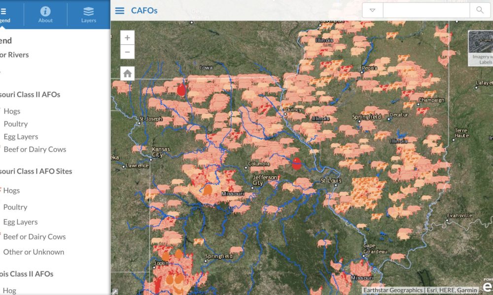
We encourage you to explore the map to learn the landscape of factory livestock farms in Missouri. The map’s icons are coded according to species and operation size. Click on the icons to view an image of the actual CAFO operation from Google Earth as well as details about the operation’s name, location, animal type, and class size.
According to records provided by the Missouri Department of Natural Resources (DNR), there were fewer CAFOs operating in our state on January 1, 2019 than there were in 2016. However, as of January 1, 2019, there were only three Class II (small) CAFOs in our state and over 500 Class I (large) CAFOs. There may be fewer total CAFOs in our state, but the existing operations are designed to hold far more animals compared to 2016.
.As stated above, CAFOs are only getting bigger in Missouri, creating more environmental and health impacts, which we’ve outlined below. To help MCE continue our work to create a just and sustainable food system, including fighting to proliferation of CAFOs in Missouri, consider donating today.
Below is a Story Map illustrating how different soil types, geological features, and water resources across the state are more susceptible to CAFO waste contamination and thereby where Missourians may be more susceptible to the harms described above. To view the Story Map in a web browser all by itself, click here.
Interactive Map of Missouri CAFOs
According to records provided by the Missouri Department of Natural Resources (DNR), there were fewer CAFOs operating in our state on January 1, 2019 than there were in 2016. However, as of January 1, 2019, there were only three Class II (small) CAFOs in our state and over 500 Class I (large) CAFOs. There may be fewer total CAFOs in our state, but the existing operations are designed to hold far more animals compared to 2016.
Health Impacts of CAFOs Story Map
As stated above, CAFOs are only getting bigger in Missouri, creating more environmental and health impacts, which we’ve outlined below. To help MCE continue our work to create a just and sustainable food system, including fighting to proliferation of CAFOs in Missouri, consider donating today.
CAFOs, Soil and Water in Missouri
Below is a Story Map illustrating how different soil types, geological features, and water resources across the state are more susceptible to CAFO waste contamination and thereby where Missourians may be more susceptible to the harms described above. To view the Story Map in a web browser all by itself, click here.