Like the Mississippi River, the Missouri River has also been highly altered to float large barges. The structures on the Missouri River, however, are harder to see unless you know what to look for.
While the U.S. Army Corps of Engineers (Corps) used both locks, dams, and river training structures to create an artificial barge channel on the Upper Mississippi River Dams, only river training structures are used on the Missouri River barge canal.
Creating a Barge Canal
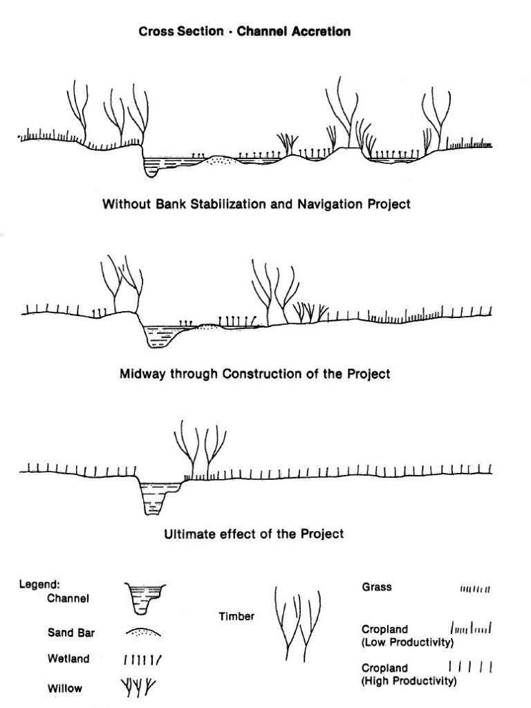
Training the river entails both narrowing and deepening it, because theoretically the new cross sectional area (height times width) of the river must equal the original area before the alterations. How these training structures, specifically wing dikes, work is shown in Figure 1 below:
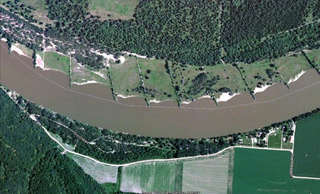 |
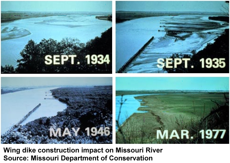
Looking closely at Figure 1 you can see the brownish river is running below a series of lines jutting out from the land at angles to the river. When you drive along the river when the river is low you can see the ends of many of them. These rock structures were built to accrete (collect) soil behind them and create new land – thus narrowing the river. The river bank opposite of the wing dikes is lined with rock creating what is called a revetment. These also helps stabilize the canal in one place. Over time the river had to flow faster to erode the river bed and deepen the channel in order for the cross section to adjust. A series of photos over time are shown in Figure 2.
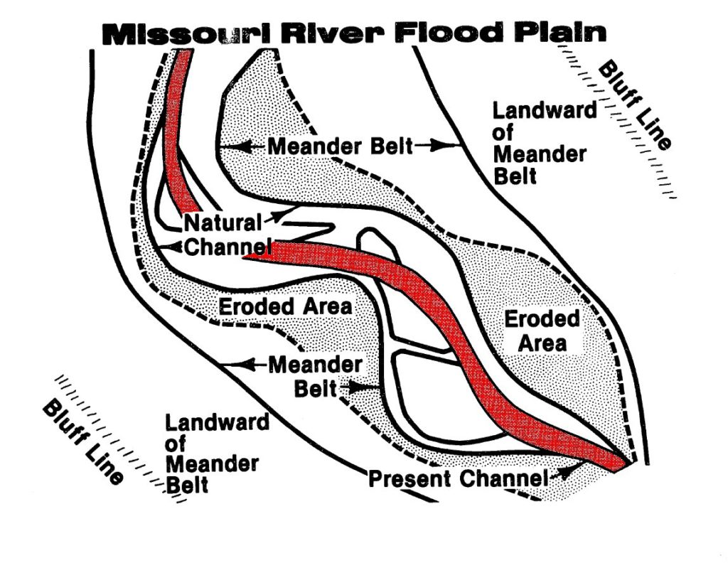
Unfortunately, the activity of channelizing a river essentially encases it into a confined static channel shown in red in Figure 3. Before channelization the river meandered across a large are constantly creating new habitat. The river floodplain was dynamic and an area near the river could not be consistently used for agriculture and other economic development. Figure 4 shows how the river floodplain was simplified and the vast majority of natural areas were lost, converted to crop production.
 |
 |
Barge Traffic on the Missouri Barge Canal
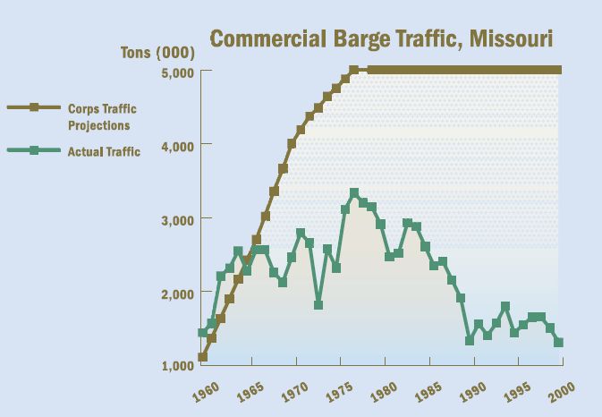
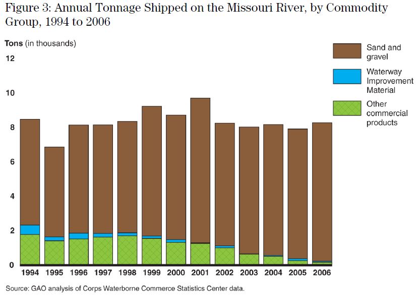
The volume of barges hauling commercial products on the altered Missouri River never reached the level the Corps projected to justify the project. They forecasted that five million tons per year, far below that which is transported on the Upper Mississippi River, but the volume peaked at just over three and a half million tons in the late 1970s. The two graphs in Figure 5 below provide the barge volume trend from 1960 to 2006. The second graph was included in a 2009 General Administration Organization report that clearly shows that almost all of the materials hauled on the Missouri Barge Canal is sand and gravel very short distances, not commercial products – the products, used to justify the project, are nearly non-existent today.
 |
 |
For detailed information regarding navigation on the Missouri River review the River Roils Blog articles and other reports listed below:
The self-proclaimed Congressional “river guy”?
A River of Special Interests Entitlement
End the Expense of Repeating Failure: Fix the River
River Roils: Political Pandering, Perennial Whack-a-mole, Collateral Damage, and Payouts
American Industrialized Agribusinesses Preparing to “Save” Cuba