In 2011, American Rivers designated the Ozark National Scenic Riverways one of the most endangered rivers in the country. Unfortunately, not much has changed since then and some things have gotten worse. MCE and Friends of Ozark Riverways want to protect the outstanding natural beauty, ecological vitality, and rich history of the Riverways.
We have an opportunity to address degradation of the treasured Ozark National Scenic Riverways and protect the resource for generations through the National Park Service’s upcoming Roads and Trails Plan. And WE NEED YOUR HELP!
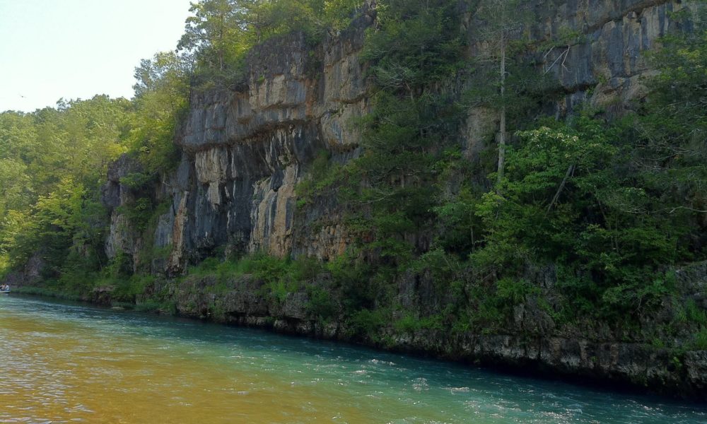
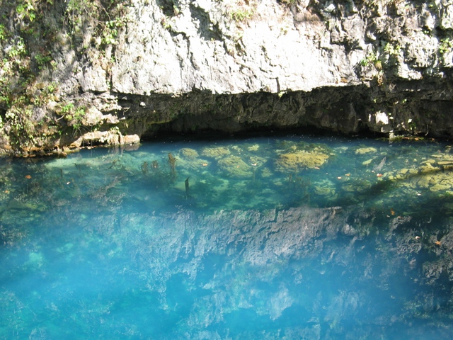
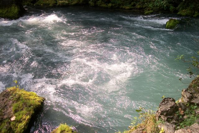
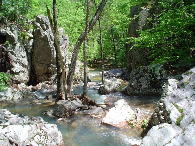
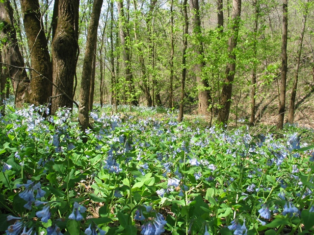
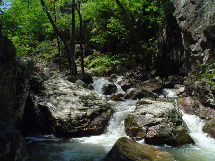
ONSR is one of Missouri’s most treasured areas for biodiversity and outdoor adventure. It is a place of exquisite natural beauty and is unparalleled in the unique and remote recreational activities it offers visitors.
In 2015, ONSR attracted 1.2 million visitors, with local economic benefits over $50-million. It was the first park of its kind to protect a river system, the Current and Jacks Fork Rivers.
See the latest maps on the Current River watershed developed by our former Clean Water Director Lorin Crandall. The General Management Plan was posted in December 2014.
The General Management Plan guides policies and practices in the Riverways for decades to come. It sets priorities for resources, staffing, and activities. The Roads and Trails Plan is a more specific plan and the Park Service is in the process of considering comments from recent open houses and drafting preliminary alternatives. The alternatives are scheduled to be released in February 2016 and we will need your help to advocate for the best alternative.
Stay tuned for more details!
MCE’s comments on the 2015 General Management Plan
The draft plan presents three alternative approaches which are outlined below.
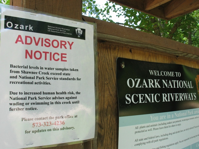
In the Riverways, unauthorized roads, overuse by all terrain vehicles and excessive equestrian use in sensitive areas have contributed to degradation including increased bank erosion, more sediment in the water, reduced habitat quality, and unsafe bacteria levels in certain river stretches. Re-directing high impact activities to areas where damage is minimized, establishing levels of use that enable the rivers to maintain quality, allowing damaged areas to heal, and organizing activities with respect for the natural resources are the keys to stewardship of the Ozark National Scenic Riverways. With your input, management of high impact activities can be integrated fairly into a GMP that preserves fishing, floating, hiking, boating, and wildlife habitat.
The Missouri Coalition for the Environment has supported policies that help restore and preserve outstanding water quality and habitat values, address threats to water quality, and maintain the quality of the Riverways for this and future generations.
Main Message: Strengthen the Management of the Ozark National Scenic Riverways through completion of a new General Management Plan (the current plan dates from 1989).
What the plan does:
The draft plan proposes management zones for land and water uses that vary in extent for each of three alternatives. The land-based zones are:
- Developed
- Resource-based recreation
- Natural
- Primitive
- Mixed-use
- Seasonal mixed-use
- Non-motorized river-based
See maps of the zones for each alternative on pages 61, 67, 75 and 81 in the plan and a comparison of alternatives in Table 13 on pages 125-30 here.
This park’s problems have included the seemingly ever-expanding presence of motorized vehicles and their maze of eroded tracks in riparian areas and on gravel bars; the explosive growth of equestrian use and proliferation of undesignated trails and river crossings (many of which are in sensitive riverine areas or on steep, heavily-eroded slopes); overcrowding in certain reaches of the rivers and resulting conflicts among user groups, coupled with the rowdy behavior of some visitors; and inadequate monitoring and enforcement of scenic easements.
Though people will differ in their views of which alternative is best, we support the Friends of Ozark Riverways belief that the National Park Service has provided a reasonable range of alternatives and deserves support for its commitment to dealing with serious problems that have developed over the years.
However, the Riverways has seen a 30% reduction in staff in the last decade, owing to decreases in funding, and there is no guarantee that funds will be enhanced to the levels anticipated by the plan alternatives. That is one reason to approach with caution higher cost alternatives that feature increased development and more intensive use like those presented in Alternative C. We favor maintaining visitation at approximately the current level while emphasizing improvements that are less demanding in terms of staff and more conducive to family recreation.
Each of the action alternatives provides for:
- A mix of recreational and interpretive activities
- More effective distribution of concession drop-off/pickup points for watercraft to reduce crowding
- Year-round non-motorized watercraft use, motor-free zones, and zones for year-round or seasonal motorized watercraft use
- Mountain biking on designated trails
- Management of roads, river access points and land access to gravel bars by zones
- Ecological restoration projects including restoration of undesignated roads, traces, trails, and river access points and crossings
- Preparation of a horse use and trail management plan (and possible permit system), improving and adding more designated horse trails, and closing and restoring many informal trails
- Increasing law enforcement for compliance
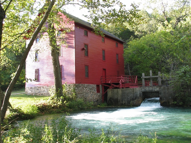
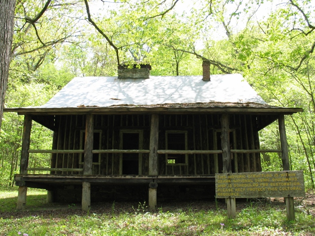
- Restoration of historic structures and cultural landscapes
- Allowing mountain biking on designated trails
- Allowing for new concessions for overnight activities such as guided float trips and guided backcountry hiking trips
- Partnering with state officials to enhance healthy game fish populations
- Partnering with counties on road management and with state officials to enhance healthy fish and wildlife populations, organizing a national park advocacy group for the Riverways and various other partnerships
- Construction of various new park operational facilities
Alternative A
The National Park Service identifies Alternative A as the environmental preferable alternative. It emphasizes traditional, non-mechanized recreation and visitor experiences that are quieter, less crowded and slower-paced. To reduce motorized intrusion it would close unauthorized roads, traces and river accesses, restore 50 miles of such roads to native vegetation, replace 15 miles of undesignated roads within primitive management zones with hiking trails, and no longer allow motor vehicles on gravel bars (walk-in or float-in day use and camping still allowed). To reduce equestrian overuse it would add 25 more miles of designated horse trails, close and restore 65 miles of undesignated horse trails, improve the design of the 23 miles of currently designated horse trails, and consider establishing a permit system for horse use within the park. To improve visitor experience and reduce conflicts among users, there would be more hiking trails, more motor-free zones, and redistribution or limit of commercial services. There are some staffing increases.
Alternative B
The National Park Service prefers this alternative. It would enhance opportunities for visitors to learn about the park’s natural and cultural resources, and provide a balance of diverse recreational opportunities with increased opportunities for education and appreciation of park resources. To reduce motorized intrusion it would close undesignated roads and access points, restore 45 miles of such roads to natural condition, convert 10 miles of roads in primitive zones to hiking trails and reduce and designate camp sites on gravel bars open to vehicles. To reduce equestrian overuse it would add 35 miles of designated horse trails, close and restore 65 miles of undesignated horse trails and unauthorized river crossings, improve the design of the 23-mile long designated horse trail system to avoid sensitive areas, establish a permit system for horse use within the park, and may allow for designated horse camping sites. To improve visitor experience, there would be a new learning center and visitor contact station at Powder Mill; two additional campgrounds at existing day use areas at Akers on the Current and Blue Spring on the Jack’s Fork; additional trails; a resumed oral history program, discovery sites, and enhancement of archive and museum collections; and strengthened monitoring, research, and preservation projects. The Cedar Grove low water crossing would be replaced with a high-water bridge. Waste systems in the park would be improved. There are staffing increases under this alternative.
Alternative C
Alternative C would accommodate higher levels of park visitation and more intensive recreation while striving to maintain the scenic natural setting and protect cultural resources. To reduce motorized intrusion it would close undesignated roads and access points, restore 40 miles of such roads to natural conditions, replace five miles of roads in primitive zones with hiking trails, and allow vehicular access only to designated sites on gravel bars. To reduce equestrian overuse it would add 45 miles of designated horse trails, and close 65 miles of undesignated trails and river crossings; it might also develop a 25-unit horse camp along the Jacks Fork. Visitor experiences would include two additional campgrounds, possible more backcountry and primitive campsites, more interaction among visitors and higher resource impacts especially in higher use area. Staffing levels would increase the most under this alternative to provide for more use and more monitoring and mitigation of impacts to resources.
The 1989 plan is due for an update in order to reverse the degradation of the Riverways. The Ozark National Scenic Riverways deserves an increased investment of staff and resources to ensure it retains its quality as Missouri’s own ‘Yellowstone’.
We prefer Alternative B, with some additions and qualifications, because it:
- Addresses concession (floaters) drop off and pick up location overcrowding in certain areas by redistributing them to include 20 new designated access points while keeping the total designated access points constant. (Alternative C also does this.)
- Provides a balance of diverse recreational opportunities;
- Enhances opportunities for visitors to learn about the park’s natural and cultural resources including discovery sites, and expanded archive and museum collections;
- Restores 45 miles of undesignated roads to natural condition while reopening some old roads for vehicular access to discovery sites;
- Reduces gravel bars designated for vehicle access which helps reduce ecosystem damage and protect public safety;
- Adds 35 miles of designated horse trails to the existing 23 miles of designated horse trails, while closing and restoring 65 miles of undesignated horse trails and unauthorized river crossings;
- Improves the design of the 23-mile long designated horse trail system to avoid sensitive areas while keeping the seven designated stream crossings;
- Establishes a permit system for horse use within the park as necessary in conjunction with development of a horse use and trail management plan;
- Establishes a new learning center and visitor contact station at Powder Mill;
- Builds two additional campgrounds at existing day use areas at Akers on the Current and Blue Spring on the Jack’s Fork;
- Restores five additional cemeteries (Alternative C does this too);
- Restores additional historic structures;
- Enhances the Riverways’ role as an archeological curatorial hub for the region.
- Adds trails;
- Resumes an oral history program;
- Strengthens monitoring, research, and preservation projects;
- Replaces the Cedar Grove low water crossing with a high-water bridge;
- Improves waste systems in the park;
- Separates back country camping (which offers some facilities) from primitive zones (which offer no facilities).
- Increases staffing.
Additionally, the Missouri Coalition for the Environment supports the following changes:
- More hiking trails (each alternative offers 15 miles or fewer)
- No horse campgrounds in the Riverways (25 sites are proposed for Alternatives B and C). We do not agree that the ONSR needs a designated horse camp in the park, preferring that this opportunity be developed by the private sector, on private land in proximity to the park. Instead of a new development of this magnitude, we ask that NPS work with existing local businesses to provide a concession horse camping operation outside the park that would have less impact on park resources within the narrow river corridor.
- Minimal restrictions on motorized boats. We oppose year-round prohibitions on boats in certain stretches of the Riverways because such restrictions would eliminate opportunities for area residents to enjoy the Riverways. We think any restrictions on boats should be minimal and driven by evidence of a problem that only restrictions will solve. If better enforcement will solve the problem we prefer that to prohibitions.
- Sensitive natural and cultural resource management that avoids new conversions of bottomland riparian forests to open fields, or artificial pasture for elk and other animals and focuses on restoration of upland meadows, woodlands, and glades with native vegetation.
- The restoration of impaired riverbanks that avoids developed facilities along the rivers, which are screened from view from the river in any case, and low impact. We suggest that heavily engineered solutions be avoided (e.g. Rock and weirs) and instead NPS talent and experience be employed to bring natural landscape design and sustainable structures appropriate to the site.
- Prioritization of solutions for problem areas that focuses on low-impacts in riparian zones. For example, the area across from Welch Spring should be restored where heavily rutted unauthorized roads mar an undeveloped bank. Damaged areas should not serve as opportunity to add new ‘hardened’ development where it does not belong and instead should receive restoration.
Additional Thoughts
MCE urges the National Park Service to approach the designation of mountain bike trails with care for the vulnerabilities of the landscape so that erosion, impacts to biodiversity and water quality are minimized.
Friends of Ozark Riverways agrees with NPS that Alternative B provides the most balance among the three alternatives, though some of our organizations and members may favor the environmentally preferable Alternative A or a mix of elements from alternatives A and B. Alternative B would provide more staff for maintenance, monitoring and enforcement while substantially enhancing visitor experience of park resources. We believe that several improvements could strengthen the plan:
-
- Scenic Easements. Although there are not changes to scenic easements proposed in this plan there are 9,257 acres of scenic easements that are intended to maintain the natural environment and scenery for the benefit of the visiting public. These easements are critical to the quality of the Riverways. They were acquired to add public value to the national park and need to be effectively monitored in a timely manner. Easement violations must be corrected promptly.
- Annual Visitation and Economic Influence. Visitation is about 1.3-1.5 million people each year. A 2011 study estimated visitor spending at $55,445,000, more than 88% of which is by non-local visitors. This spending combined with NPS employment accounted for 845 jobs, or 16% of total employment in Shannon and Carter counties. We support this high-valued investment in the Ozark region of south-central Missouri, understanding that a well-managed park and the visitors it attracts may be the most important contributors to the long-term economic health of local communities.
- Wilderness. The GMP review includes one small, undeveloped backcountry/wildland area of approximately 3,400 acres near Big Spring. The area, which was acquired as a state park in the 1920’s and later became part of the ONSR, has been continually managed as an undeveloped wild area and we support that approach. We also support the use of prescribed fire to manage wildland quality. The NPS is proposing in each alternative to recommend some portion of the Big Spring area as qualified for federal wilderness protection (Alternative C proposes 1,779 acres for Big Springs wilderness). Management would continue largely unchanged as it has been but with the recognition that it can provide a true wilderness experience, which would be an addition to riverways offerings we support the NPS-preferred Alternative B which recommends 3,430 acres for wilderness management , while recognizing that official designation as federal wilderness is beyond the scope of the ONSR GMP.
- Horsepower Limit. Zoning for horsepower limits on boats have been part of existing regulations since the River Use Management Plan of 1989. FOR supports the balanced approach of motor-free zones for upper reaches of the Current and Jacks Fork rivers and seasonal or year-round provision for motors on other reaches as proposed in Alternative B. (NPS recognizes that the present and proposed 60/40 horsepower limit is in violation of the Code of Federal Regulations and is proposing a rule change process in order to continue allowing it.)